Sentinel site networks as a mechanism to evaluate progress toward meeting restoration goals in altered and unaltered landscapes
Author contributions: All authors conceived the conceptual idea; JBW, KO'C, KW, CC, KKJ, RFA, CRW, JAC, KB established the sentinel site criteria; all authors applied the criteria to southern California and vetted the sentinel site selections; JBW, EDS wrote the manuscript; all authors edited the manuscript.
Abstract
Establishing appropriate restoration targets, tracking progress toward those targets, and determining appropriate adaptive intervention are some of the greatest challenges to successful ecosystem restoration. Addressing these challenges is often informed by the use of “reference sites” that represent relatively unaltered or historical conditions and conceptually can be used to provide context and comparison for restoration projects. In reality, contemporary “unaltered” sites have often been manipulated by centuries of cultural practices and “pristine” conditions cannot be defined. Moreover, in highly altered landscapes or where stressors are continuing to rapidly reshape ecosystem structure, few or no sites may be unaltered enough to serve as pristine or aspirational reference standard sites for restoration. To address this challenge, we adapted the concept of “reference sites” to a framework for developing sentinel site networks, which consist of sites along a gradient of condition. These sites are selected for long-term monitoring to track ecological conditions through time, to evaluate the effect of regional trends in external conditions or stressors, and to document progress toward site-specific goals and regional objectives. Developing a sentinel site network involves screening sites based on condition, stressors, representativeness, and feasibility for long-term monitoring, informed by input from regional experts and stakeholders. The resultant network includes sites along a gradient of condition, geographical representation, and management that can be customized or regionally based on local constraints. We demonstrate the application of this process through the development of a sentinel site network for coastal wetlands in the highly developed southern California (U.S.A.) region. This process can be readily adapted to other habitats globally and may be particularly useful in habitats that have been highly impacted by human activities.
Implications for Practice
- We recommend shifting from a traditional approach of relying on “unaltered” reference sites to a sentinel site approach.
- We developed a conceptual framework for sentinel site networks, providing a more comprehensive understanding of regional conditions and improving the ability to understand trajectories, which is critical for evaluating progress toward meeting conservation goals and climate resilience.
- The framework was successfully applied to southern California coastal wetlands and is adaptable to other habitats and regions.
- A sentinel site approach will ultimately improve restoration practices through an enhanced understanding of factors that contribute to restoration success.
- Building stakeholder participation in the development/implementation of sentinel site networks helps build collaborative communities of practice and fosters cooperation and knowledge transfer, leading to effective regional ecosystem management.
Introduction
Defining restoration success can be problematic and judged in many ways depending on the motivation for the restoration (Baker & Eckerberg 2016; Zedler 2007). In all cases, success depends on clear goals, a strategy for achieving them, and the ability to track and adaptively manage projects to accommodate changing conditions (Van Diggelen et al. 2001). Success has been defined in different ways for different systems. For wetlands, it can be defined as meeting specific physical or hydrologic targets or ecological indicator values (Zedler 2007); for semiarid uplands as exhibiting specific attributes of soil stability, hydrologic function, and biotic integrity (Herrick et al. 2006); and for grasslands as having levels of plant and functional group diversity and species composition similar to those found in remnant natural sites (Martin et al. 2005). Moreover, establishing restoration targets and measurable indicators is challenging in regions that have been widely altered by recent human activities. This challenge is exacerbated by climate change effects, which are significantly altering underlying environmental conditions. This, in essence, can create “moving targets” for restoration and recovery, necessitating modifying management approaches and/or restoration goals (Ingeman et al. 2019; Zabin et al. 2022).
Ecosystem restoration should be guided by an understanding of ecosystems across a range of historical continuity, from lightly disturbed systems to those heavily managed through socio-ecological relationships (Steyer et al. 2003; Simenstad et al. 2006; Montgomery 2008; Daems et al. 2024). This can involve evaluating historical conditions prior to contemporary human disturbance (Stein et al. 2010), but the lack of modern natural analogs and poor historical data complicates restoration goal setting (Shackelford et al. 2021). This evaluation and subsequent management targets should account for the fact that human manipulation of habitats has occurred for millennia (e.g. dispersal of plant propagules, deliberate landscape engineering; Wehi & Lord 2017; Ens et al. 2023). Traditionally, this challenge has been addressed through paired comparison of restoration sites to “natural” reference sites (Brinson & Rheinhardt 1996), defined as systems that display “conditions found in undisturbed ecosystems and landscapes” (Smith et al. 1995). Comparisons of restored and reference sites have proven to be a powerful approach in estuarine systems (Raposa et al. 2018). However, a meta-analysis of such comparisons revealed that restoration sites often do not approximate reference conditions even after many decades (Moreno-Mateos et al. 2012). This is largely due to the fact ecosystem variation based on stochastic events and historic and ongoing land use changes makes it challenging to set restoration targets (White & Walker 1997). Moreover, the use of paired reference sites may not be possible when “natural” unaltered conditions do not exist due to pervasive alteration, climate change effects and other anthropogenic stressors (Shackelford et al. 2021). The situation can be particularly challenging for habitats without natural analogs due to changing land and water use practices, climate change, and the effects of other stressors where a complete return to the original condition is very unlikely or not feasible (Stein et al. 2021).
Several authors have highlighted challenges in the application of reference site monitoring for gaging restoration performance. Steyer et al. (2003) discussed the difficulty of using paired reference sites in coastal Louisiana and proposed a range of reference locations across hydrogeomorphic gradients. Similarly, Moorhead (2013) noted the differences in structure and function of early (restored) and mature (reference) ecosystems, and the inherent variability that may not be fully represented in reference systems. White and Walker (1997) recommended that reference sites must encompass a full range of spatial and temporal variability, a concept further extended by Shackelford et al. (2021) to include future conditions. A more inclusive concept of reference, termed the “reference domain” was promoted in the early 1990s to encompass variations of ecosystems across broad geographic areas, including both natural and disturbance-mediated variations (Smith et al. 1995; Brinson & Rheinhardt 1996).
Brooks et al. (2016) expanded the concept of “reference” by suggesting that wetland ecosystems vary across space and time, and reference sites should include sites that encompass the variability of a regional wetland type in a reference domain, including natural or quasi-natural wetlands that either occur presently in the region or occurred there at one time. They defined “reference standard wetlands,” as sites with the highest level of ecosystem function (Brinson & Rheinhardt 1996) and therefore the sites from which reference standards for judging restoration success are developed. In their proposal for a National Reference Wetlands Registry, Brooks et al. (2016) called for a network of reference wetlands spanning several gradients and including the full range of common types of wetlands, representing the range of conditions from minimally disturbed (ecologically intact) to severely disturbed sites (degraded ecological integrity and functions). This is similar to the “least disturbed” or “best attainable” reference conditions proposed by Stoddard et al. (2006), who suggested that the process of setting restoration goals should include a broad range of comparison sites depending on the condition of the landscape in which the restoration is occurring. The ultimate goal of such efforts can be to “future proof” restoration by increasing resilience and adaptive capacity (Frietsch et al. 2023).
Building on these ideas, we propose that rather than seeking ideal reference sites which are challenging to find in regions with highly altered ecosystems, the goal should be the identification and monitoring of “sentinel sites,” which are sites that represent a range of conditions across the reference domain, that may be less than pristine in all characteristics but provide a gradient for comparison to restoration sites. From this perspective, we define “sentinel sites” as sites that are designated for long-term monitoring to track ecological condition through time, evaluate the effect of trends in external conditions/stressors, track progress toward site-specific goals and regional objectives, and offer a foundation for refining these goals and objectives based on observed long-term changes in systems.
A network of sentinel sites should include relatively unaltered, restoration, and currently impacted or degraded sites, reflecting the reference network concept promoted by Brooks et al. (2016) and Otte et al. (2021). Considering a broader suite of reference data sources allows greater flexibility in how we judge project success (Suding et al. 2015) and allows for the use of reference sites as planning tools to promote ecological recovery. Sentinel sites will provide comparison points to evaluate long-term restoration effectiveness, inform adaptive management, and track ecological trends over time. This network can help identify responses to broader drivers like climate change, assess progress toward regional goals, and adjust goals based on changing conditions. While these ideas originate from wetland restoration (given the pronounced regulatory drivers for compensatory mitigation of wetland losses), they can apply to all degraded habitats.
We propose a process for developing a sentinel site network that consists of selecting sites based on condition, stressors, representativeness of ecosystem type, geographic distribution, and feasibility of long-term monitoring. The resultant network includes sites in different categories of condition and management and can be customized regionally based on physical gradients and local constraints. We demonstrate the application of this process through the development of a coastal wetland sentinel site network for the highly developed and altered southern California (U.S.A.) coastline, where a consortium of 18 state and federal agencies has developed a Regional Strategy (Southern California Wetland Recovery Project [SCWRP] 2018) for the recovery of coastal wetlands that includes quantitative performance metrics, targets, and adaptive management strategies. The approach illustrated by our case study can readily be replicated for other habitat types globally, and may prove particularly useful in contexts where widespread habitat alteration makes a more traditional reference site approach challenging to implement.
Methods
Development of a Sentinel Site Network
- Evaluate progress toward meeting regional restoration/enhancement objectives.
- Assess the overall ecological condition within a region by assessing specific ecosystem functions using a variety of indicators.
- Assess how well restored sites within or outside the sentinel site network are recovering compared to reference or a gradient of conditions at a regional level.
- Interpret long-term trajectories of condition and function relative to trajectories at other sentinel locations within the region, or the region as a whole.
- Continue to test and refine indicators of ecosystem health and resilience.
- Standardize regional monitoring so that evaluations and comparisons can be made at larger spatial scales.
- Facilitate cross-project data sharing and collaboration.
Development of a sentinel site network will be guided by three basic philosophies: (1) The selection process will be transparent, well-documented with data and robust metadata (with the latter both exposing the decision-making process and informing future revisions), and repeatable. (2) The selection process and workflow will be transferable across different regions so that networks can be expanded over time to encompass other geographies and/or habitat types. (3) Management of a sentinel site network will be an ongoing and iterative process that is informed by new information and perspectives gained from previous monitoring.
Multiple categories of sentinel sites need to be established that can best encompass the range of conditions within the region. The range of conditions represents the entire reference domain from most to least degraded in the current landscape. In many cases, significant changes from the range of conditions typical over the past hundreds or even thousands of years, or from the past trajectory of change, may be considered degradation. These conditions often include cultural practices that affected the ecosystem, and Indigenous perspectives should be considered when defining the disturbance gradient (Fischer et al. 2021; Reid et al. 2021). Rather than bounding the upper gradient by historical reference condition, the continuum can be anchored by the region's historical trajectory, including impacts by cultural practices and socio-nature interactions.
We propose three categories of sentinel sites: relatively unaltered sites (herein referred to as reference sites), restoration sites, and other sites of interest that together provide a representation of conditions (Fig. 1). These should be distributed to represent the region's ecosystem characteristics, stressors, and diversity, ensuring valid conclusions for management decisions. Over time, a site's position on the condition gradient may shift, such as restoration sites becoming reference sites or relatively unaltered (reference) sites degrading to become other sites of interest. Long-term monitoring, especially in the context of climate change, allows for reinterpreting restoration targets and adapting the network accordingly.

Reference Sites
Reference sites are typically those that have experienced the least degree of anthropogenic alterations, negative impacts, or stressors relative to other sites in the region. These sites may be temporarily affected by storms, fires, floods, or other typical disturbances that do not fundamentally alter the long-term characteristics or function of the site. Ideally, reference sites should have the ability to be more resilient by maintaining their intrinsic functions when subjected to short- and long-term disturbances, where a resilient system has the ability to maintain functions when subjected to disturbance (Walker et al. 2004; Masselink & Lazarus 2019). Reference sites will provide data to determine (or define) reference standard conditions (Brinson & Rheinhardt 1996). The reference standard is the condition used as a basis of comparison to judge the performance of a restoration site. These standards serve as a basis for comparison when assessing the ecological attributes of a particular area. Depending on the project, the reference standard for a given variable can be anything from the pre-industrial condition to the best attainable condition given past cultural practices and current constraints of the landscape. Defining the reference standard is a management decision that is made for each project, and a manager could decide to use one or more types of reference sites to help establish reference standards.
Restoration Sites
Restoration sites are those undergoing or have undergone large-scale restoration and can be tracked over time to understand their long-term ecological progression. These sites are tracked over time to monitor their long-term progress and may eventually become reference sites. Restoration sites have undergone substantial physical or hydrologic modification that is aimed at improving function and that affects a large portion of the site. These modifications should have resulted from deliberate human intervention and management activities aimed at improving or restoring the ecological structure, function, and resilience of degraded ecosystems.
In contrast, if a small-scale restoration has occurred (e.g. community native planting efforts or invasive vegetation removal in a small area) within a site (referring here to the entire coastal wetland), then that alone does not qualify the site as a restoration site in the sentinel site network. Smaller scale restorations do not automatically improve ecological structure, function, and resilience at a large scale. For example, native planting efforts along an upland berm to improve erosion do not immediately qualify a site as a sentinel restoration site due to the small-scale impact.
Other Sites of Interest
The last category of sentinel sites captures other sites that represent the entire gradient of condition as shown in Figure 1. Tracking multiple sites along the entire gradient of condition that may be of management interest (i.e. the reference domain) is what distinguishes a sentinel site network from the traditional concept of reference site monitoring. This allows sites to be more fully evaluated for their position along a gradient of condition and their trajectory over time. These sites may be impacted by or at risk of substantial impacts from major development projects, modified hydrology, altered sediment input, fill placement, invasive species, or are heavily degraded. These sites allow for a regional evaluation along a gradient of impacts, compared to the other categories. Additionally, a site may be included in this category because of existing long-term monitoring, landowner willingness, available funding, or the potential for future restoration.
Site Selection
A general approach and workflow for establishing a sentinel site network will be used with six main steps that allow consideration of the complete gradient of condition at spatially and typologically representative sites (Fig. 2A).

Step 1: Generate a Map of Candidate Sites
Generate a table of all potential sites within the target geographic region and map the habitat types, site boundaries, general setting, major stressors, and relevant management overlays (e.g. reserve boundaries). Maps will help establish the list of candidate sites and provide an overview of site characteristics.
Step 2: Develop Region-Specific Reference Criteria
Establish reference criteria. Reference criteria may be region-specific, but should generally have the following attributes: represent key structural attributes that drive ecosystem function; account for important landscape-scale stressors; have sufficient resolution to differentiate sites based on their position along a gradient of condition or function; be applicable to all ecosystem types in the region that the reference sites are intended to represent; and have the ability to obtain access permissions.
Step 3: Select Reference Standard Sites
Evaluate unaltered reference sites relative to the clearly established reference criteria. Unaltered reference sites will be the first category of sentinel sites selected because they provide an important end member of the sentinel site continuum and are typically the most difficult sites to identify.
All candidate sites will be evaluated for reference and verified following a process, as outlined in the workflow schematic in Figure 2B. Unaltered reference sites will be selected based on the level of landscape-scale disturbance that might be affecting the site. Ecosystem function may vary based on the level of disturbance that a site is subjected to, and individual functions may be affected differently based on stress and the type/setting of the site (Lomnicky et al. 2019). Therefore, potential unaltered reference sites will be evaluated at the landscape level rather than for specific functions (i.e. reference standard) because not every site will provide high levels of every ecosystem function. Reference sites will also be resilient to stress and have the ability to recover in a reasonable time frame from stressors associated with natural disturbance cycles. It is important to note that the criteria for selecting reference sites will vary by region based on the physical setting, ecosystem type, and inherent constraints of the landscape.
The reference criteria will first be applied to all candidate sites to select a pool of candidate unaltered reference sites. Initial screening will consist of remote evaluation using readily available Geographic Information System or other spatial data, review of readily available site-based data from previous monitoring and assessment, and final review by a panel of regional experts with sufficient expertise to ensure that candidate sites are not erroneously included or excluded (Fig. 2B). Once a pool of candidate reference sites is generated, the sites will be evaluated for geographic and typological representativeness. Additionally, candidate reference sites will be evaluated for suitability for long-term monitoring, landowner willingness, ease in site accessibility, and funding. If a site has an existing or funded long-term monitoring program, then inclusion in the sentinel site network would be cost-effective. In contrast, if a landowner is unwilling to participate or allow monitoring, then that site should not be considered. This process is meant to be iterative. Therefore, if the pool of candidate reference sites is not representative, then the sites will be reevaluated, and the process repeated.
During this phase, reference sites will also be verified with site visits to confirm conditions based on field indicators typically used for assessment to create a pool of verified sites. Sites can further be removed during this process based on expert advice/site knowledge or on ancillary data collection that suggests a site is not in reference condition. Once a pool of verified sites is generated, the sites are re-evaluated for representativeness to create the final pool of reference. The final pool of reference sites will be reevaluated over time based on regional monitoring and evolving knowledge so that the final reference pool is considered a living list to be updated regularly.
Step 4: Select Additional Sentinel Sites
Select sites in the other sentinel site categories. The inclusion of the other sentinel sites (i.e. restoration and other sites of interest) in addition to unaltered reference sites provides additional information that can be used to represent the range of conditions as shown in Figure 1 and that are representative of regional habitats. Non-reference sentinel sites provide critical context for evaluating long-term efficacy of restoration and management actions and informing adaptive management programs, particularly in highly altered or rapidly changing landscapes. Candidate sites for inclusion as non-reference sentinel sites will be evaluated for suitability to include in the sentinel site network based on the following: (1) Long-term monitoring—there may be some impacted or restored sites that have established long-term monitoring programs but would not be considered reference sites. These sites will be considered for inclusion in the network due to the existence of established monitoring or historical data that can provide valuable regional context. (2) Funding—some sites may not have established monitoring programs in place but have willing partners to fund long-term monitoring. These sites will be prioritized for consideration to be included in the network, subject to meeting other appropriate criteria. (3) Leveraging of opportunities—sites in the network with long legacy or historical data sets will also be considered for inclusion in the network since they can support regional trend analyses. In contrast, candidate sites may be excluded due to inability to gain access permission.
Step 5: Generate List of Sentinel Sites
Generate a list of sentinel sites for review by managers and other stakeholders, including regulatory agencies, local managers, Indigenous groups, and community members. This ensures the feasibility of adding sites to the network and incorporates expert input for long-term ecological restoration (Gann et al. 2019). The process of developing sentinel sites needs to be informed by input from regional technical experts and implementing agency staff who will incorporate sentinel site monitoring into their regulatory and grant funding programs to support program growth and longevity. Once a final list of sentinel sites is established, details of each site, including boundary information, general description, and access information will be compiled on a publicly accessible data portal so that the site list can be reviewed, updated, and refined over time. Ideally, the same portal will be used to house current monitoring protocols and data produced by sentinel site monitoring to allow evaluation of sites of interest against the sentinel site network.
Step 6: Iterate and Re-Evaluate Over Time
This overall process is iterative as the final list may need to be adjusted based on the review process. Furthermore, the final list will be dynamic and revisited over time based on additional data/information and evolving needs. Individual sites may change categories over time (e.g. go from restoration to reference standard) based on changing conditions. Furthermore, the sentinel site network should be considered dynamic, and sites may be removed, or new sites may be added over time.
Results
Southern California Case Study
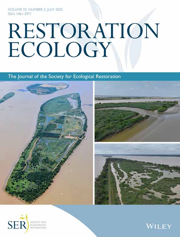
Southern California coastal wetlands provide an opportunity to demonstrate the application of the sentinel site network. A key challenge in wetland management is the division of responsibility among various agencies, each with its own monitoring sites, methods, and protocols. To improve coordination, the Southern California Wetlands Recovery Project (WRP) was formed in 1997. The WRP coordinates efforts to restore and protect wetlands from the U.S.-Mexico border to Point Conception (Fig. 3). In 2018, the WRP developed a Regional Strategy and vision for restoring and protecting southern California's wetlands that includes a set of quantitative objectives and management targets (Southern California Wetland Recovery Project [SCWRP] 2018). As part of this, they are developing a coordinated monitoring program to track progress and support consistent approaches for agencies. Establishing a coastal sentinel site monitoring network is a key recommendation of the strategy. Application of the proposed sentinel site selection approach (described above) is briefly illustrated below for the southern California region. For more details, see the Southern California Wetlands Recovery Project Technical Report 2024 (SCWRP 2024).

Step 1: Generate a Map of Candidate Sites
A total of 118 coastal wetlands were considered for inclusion in the sentinel site network for southern California (Fig. 3). Of the 118 estuaries, three were categorized as Bay Estuaries, 11 as Intermediate Estuaries, nine as Large Lagoons, 17 as Open Bays, 21 as River Valley Estuaries, and 57 as Small Creeks or Lagoons. Twenty-nine estuaries were in the San Diego subregion, 30 estuaries in San Pedro, 19 in Santa Monica, 9 in Ventura, and 31 in Santa Barbara. For a complete list of estuaries, see SCWRP (2024).
Step 2: Develop Region-Specific Reference Criteria
Six region-specific criteria were developed for the unaltered reference sites (Table 1) by the WRP Scientific Advisory Panel (SAP). Criteria were divided into two categories: primary and secondary. Primary screening criteria were used to evaluate all sites, while secondary screening criteria were only used for some sites. Secondary criteria are those that may depend on site-specific information or the availability of data (e.g. data that are used to evaluate the criteria may not be available at all sites). For example, the criterion “habitat stability,” where a reference site has similar habitat composition to its historic composition, is considered a secondary screening criterion because loss of habitat may not impact the overall integrity of the site (Table 1). Therefore, this criterion should be combined with Best Professional Judgment (BPJ) to determine if extensive habitat loss over time should exclude the site from being a reference site. In the WRP SAP collaborative process, the SAP determined that the unaltered and least degraded sites were sites that had the least amount of change by large-scale post-industrial human activities, such as diking, hydrological alteration, and invasion by non-native species. Categorical ratings were developed to score each of the criteria (Table 2). Detailed methods for each criterion can be found in SCWRP (2024).
| Criteria | Category |
|---|---|
| Mouth/inlet state: A reference site has a mouth/inlet that has little management and a low level of hardening relative to the best conditions in the region. | Primary |
| Buffer condition: A reference site should have a large natural buffer and should be within the top quartile of buffer conditions in the region. | Primary |
| Watershed stressors: A reference site has few direct or upstream inputs or stressors. | Primary |
| Rapid condition assessment: Using the California Rapid Assessment Method (CRAM), a reference site is within the top quartile of the distribution of CRAM scores in the region. CRAM is a standardized rapid assessment method for monitoring the conditions of wetlands throughout California (Sutula et al. 2006; Collins & Stein 2018). | Primary |
| Invasive species: A reference site has an overall low percentage of highly invasive vegetation species and the invasive species do not impact the integrity or functioning of the marsh. | Secondary |
| Habitat stability: A reference site has similar marsh and unvegetated flat habitat composition to its historical composition in consideration of the natural dynamism of the system (e.g. opening and closing of the estuary mouth). | Secondary |
| Criteria | Score | Score description | Method |
|---|---|---|---|
| Mouth state | 0 | Extensive mouth management and hardening | To evaluate mouth state, the mouth was categorized by its intensity of maintenance (how extensive and how frequent) and extent of hardening. Google Earth time series and the California Coastal Records Project imagery were used to evaluate mouth hardening, while California Coastal Commission permits and direct communication with estuary managers was used to evaluate mouth manipulation through time |
| 1 | Mouth management with hardening | ||
| 2 | Hardening without mouth management | ||
| 2.5 | Mouth management without hardening | ||
| 3 | No mouth management and no hardening | ||
| Buffer condition | 0 | The site scores in the bottom quartile | To evaluate buffer condition, a 250 m buffer was delineated around each wetland with the National Land Cover Dataset (NLCD) overlayed. The ocean was excluded from the buffer, and within each buffer, the NLCD condition was categorized as natural, urban, and agriculture. Frequency distribution curves were created to evaluate the distribution of scores across the region |
| 1 | The site scores in the third quartile | ||
| 2 | The site scores in the second quartile | ||
| 3 | The site scores in the top quartile | ||
| Watershed stressors | 0 | Many point source stressor that directly discharges into the wetland | To evaluate watershed stressors, we evaluated point source stressors and natural land cover within a 250 m buffer. This infers that a more natural buffer would help buffer against non-point source stressors. Two data types were used: (1) the California wastewater treatment facilities shapefile (hosted on ArcGIS Hub, compiled from U.S. Environmental Protection Agency [EPA] Facility Registry Service [FRS] and Integrated Compliance Information System [ICIS]) and (2) National Land Cover Database cover maps |
| 1 | Few direct point source, but contributing watershed is less than 50% natural land cover | ||
| 2 | Few direct point source and contributing watershed is greater than 50–75% natural land cover | ||
| 3 | Few direct point source and contributing watershed is greater than 75% natural land cover | ||
| CRAM | 0 | The site scores in the bottom quartile | California Rapid Assessment Method (CRAM; Collins & Stein 2018) is a rapid condition assessment tool that was used to screen sites based on their similarity to statewide CRAM reference sites, which were defined as sites within the top quartile of all sites monitored. CRAM scores were extracted from the statewide database and frequency distribution curves were created to evaluate the distribution of scores across the region |
| 1 | The site scores in the third quartile | ||
| 2 | The site scores in the second quartile | ||
| 3 | The site scores in the top quartile | ||
| Invasive species | 0 | Invasive CRAM score of D, 31–100% of co-dominant species in the Assessment Area (AA) are invasive | To evaluate invasive species, the invasive submetric-score from CRAM was extracted. Invasive species were scored under the Biotic attribute of CRAM. The number of invasive co-dominant species for all plant layers combined was assessed as a percentage of the total number of co-dominants. The invasive status for California wetland and riparian plant species was based on the California Invasive Plant Council (Cal-IPC) list of invasive plants |
| 1 | Invasive CRAM score of C, 21–30% of co-dominant species in the AA are invasive. | ||
| 2 | Invasive CRAM score of B, 11–20% of co-dominant species in the AA are invasive. | ||
| 3 | Invasive CRAM score of A, 0–10% of co-dominant species in the AA are invasive. | ||
| Habitat stability | 0 | 90% + loss of marsh and flat habitat | To evaluate habitat stability, marsh and flat habitat types were compared between historic and current imagery using National Wetlands Inventory (NWI) imagery. Historic calculations were derived from the United States Geological Survey (USGS) T-Sheets. The percentage change was calculated as the difference between the two. Loss refers to either the direct loss of the habitat or conversion to another habitat type |
| 1 | 51–90% loss of marsh and flat habitat | ||
| 2 | 11–50% loss of marsh and flat habitat | ||
| 3 | Less than 10% loss or gain of marsh and flat habitat |
Criteria for selecting reference sites will vary by region based on the physical setting, ecosystem type, and inherent constraints of the landscape. Therefore, for individual application, regions will need to develop their own criteria. However, we do recommend that sites be screened and evaluated based on the region-specific criteria following the steps outlined in Figure 2B.
Step 3: Select Reference Sites
Once reference criteria were defined, reference sites were selected following the workflow outlined in Figure 2B. The SAP ranked all 118 coastal wetlands based on the outlined criteria and used scores to eliminate coastal wetlands from the pool of candidate reference sites. Sometimes scores had to be adjusted based on BPJ. For example, mouth management may be critical to preserving ecosystem function at a site. If a hardened system is subject to artificially increased closure due to decreased tidal prism or inability of the mouth to migrate, then active management may be critical in maintaining function. Sites were also removed when local experts had firsthand familiarity with habitat degradation or anthropogenic impacts to a wetland that they deemed too substantial for the site to serve as a reference site. To aid in finalizing the candidate pool of reference sites, the SAP used available field-based data to screen sites. For example, vegetation surveys were used to evaluate native species richness to help confirm that sites considered as reference standards had higher native species richness than other sites in the region. Full validation of sites should be conducted across multiple metrics; native species richness is only one example here.
During this step, sites were also evaluated for representation across wetland type and geographic spread. Additionally, reference sites were evaluated for other prioritizations, such as long-term monitoring, landowner willingness, ease in site accessibility, and funding. Of the 118 coastal wetlands that were evaluated using the criteria listed in Tables 1 and 2, 14 sites were selected as reference sites (Table S2; Fig. 4).

Step 4: Select Additional Sentinel Sites
An additional nine restoration sites and 14 other sites of interest were selected for inclusion in the sentinel site network. Selection of the final list of sentinel sites relied on BPJ from the SAP and other local experts. For example, each member of the SAP independently used the scores generated from the scoring exercises and their own BPJ to generate individual lists of sentinel sites. Discrepancies were discussed and resolved to produce a final list of candidate sentinel sites.
Step 5: Generate List of Sentinel Sites
The final list of sentinel sites was distributed to the member agencies of the WRP, both the WRP Wetland Managers Group and Directors Group, for review and comments. These groups are composed of both resource and regulatory agencies, such as the California Coastal Commission, State Water Resources Control Board, California Department of Fish and Wildlife, California Natural Resources Agency, California Environmental Protection Agency, State Coastal Conservancy, United States Fish and Wildlife Service, the National Marine Fisheries Service, and many more.
Step 6: Iterate and Re-Evaluate Over Time
The SAP selected 14 reference sites, 9 restoration sites, and 14 other sites of interest, for a total of 37 sites (Fig. 4). This list is meant to be dynamic, and the final list will be revisited over time based on additional data/information and evolving needs. Sites can be added or removed from the network, and sites can shift between categories in response to changing conditions. Other sites of interest may be the most likely to change in response to stressors (if the sites are not protected) or because they get restored; hence, this category may be the most dynamic.
It is important to note that assignment exercises such as these can be difficult, as sites often tend to resist clear classification. Placing sites in different categories should not be strict and inflexible, but instead serve as a logical, internally consistent tool for organizing thinking and action based on multiple lines of evidence (Peterson et al. 2003; National Park Service 2013). The use of BPJ is a key feature of this process, which has been shown to be a viable means for making decisions and developing consensus, especially when used alongside data-driven approaches (Teixeira et al. 2010; Feio et al. 2016). The inclusion of multiple sites along the gradient (Fig. 1), the re-evaluation of sites (and the gradient itself) over time, and the ability to use information from any site to make informed decisions should improve confidence in the assignment of sites to categories (Fig. 4). Despite difficulties in assignment, a sentinel site network provides a mechanism to contextualize and assess both trajectories and performance of sites and the region as a whole (Fig. 5).

Discussion
The use of reference sites to interpret restoration trajectories is a well-established practice, with extensive guidance on the selection of reference sites (Harris 1999; Keeneleyside et al. 2012; Pollock et al. 2012; Shackelford et al. 2021; Toma et al. 2023). However, the development of a sentinel site network is a preferable approach in complex and highly altered landscapes. When traditional reference sites are not available, some suggest reference models might rely on secondary sources of information such as paintings, site descriptions, or even palynological and archeological records (Stein et al. 2010; Clewell & Aronson 2013; Gann et al. 2019). Here we demonstrate an alternative approach of developing a sentinel site network that better represents the complete gradient of condition and provides flexibility and robustness to accommodate complex and altered landscapes. This approach is consistent with the recommendations of Shackelford et al. (2021), is an implementation of the reference network concept by Brooks et al. (2016), and includes sites that represent the entire reference domain (Smith et al. 1995; Brinson & Rheinhardt 1996).
Shifting from a traditional reference site approach to a sentinel site network accommodates diverse and heterogeneous sites varying in typology, size, and condition, while still providing a mechanism to contextualize restoration projects and track condition or function trajectories. Multiple site types help assess baseline conditions, track past restorations, and differentiate “ideal reference” from “management targets” (Gann et al. 2019; Shackelford et al. 2021). Continued monitoring of the network also has the potential to support the development and evaluation of performance standards for compensatory mitigation projects and provide readily available reference sites for use in future mitigation monitoring programs. Leveraging ongoing mitigation monitoring through the inclusion of those sites within the network can free resources and funding to expand the network to include more sites that may be lacking funding. This effort will have the reciprocal benefit of providing resources and capacity for ongoing data collection at sentinel sites, which is necessary to develop data sets of sufficient duration to detect regional trends that can be used to contextualize site-specific management response trajectories. These trajectories are critical to understanding the effects of restoration actions relative to the effects of short-and long-term climate patterns or regional stressors (e.g. fires and algal blooms). Differentiating these effects helps guide adaptive management actions and can improve understanding of regional condition gradients and how they are changing over time.
Using a range of screening tools, BPJ, and stakeholder input, along with categorizing sentinel sites, promotes broad applicability and long-term sustainability of the sentinel site network. Stakeholder involvement in the development process builds confidence in the selection and use of the network (Reed et al. 2009) and ensures that the network has the potential to address a range of ecological and social goals (Viani et al. 2017). This involvement promotes acceptance in the use of the network in permit and grant-funded monitoring requirements and provides opportunities to build partnerships with community-based organizations who can assist in sentinel site monitoring. Investing in generating practitioner and stakeholder input in the process can promote the efficiency and applicability of a sentinel site network. Robust stakeholder engagement throughout the process in our southern California case study resulted in multiple practitioners and agencies recognizing potential benefits of the sentinel site network and committing to support implementation to some degree. This local investment can also help support the development of long-term data sets and enhance understanding, appreciation, and stewardship of local wetland resources (Mamun & Natcher 2023; Reeves & Bonney 2023).
The inclusive development process of the sentinel site network can support diverse criteria for judging restoration success, recognized as legitimate by divergent stakeholders (Baker & Eckerberg 2016). Success can be defined based on ecological integrity, capacity to provide specific functions or processes, or the ability to provide services to local communities. Definitions can also include perspectives based on cultural practices, acknowledging that management decisions are often influenced by cultural beliefs, world views, priorities, and norms, and people from different backgrounds will make different choices (Ens et al. 2023). Moreover, these definitions may evolve with shifting conditions and priorities, necessitating periodic re-evaluation of restoration sites relative to regional conditions (Keeneleyside et al. 2012; Shackelford et al. 2021). For example, changing climatic conditions may require consideration of success criteria based on anticipated future conditions instead of based on the current landscape conditions. Ultimately, definitions of success must account for the potential novelty of habitats in the contemporary landscape and the non-stationarity of those habitats in light of climate change and other persistent stressors. Ongoing monitoring of a diverse sentinel site network allows stakeholders to periodically evaluate “success” in a variety of ways.
The southern California case study offers valuable lessons in the development and initial implementation of a sentinel site network. There are over a hundred coastal wetlands of varying sizes along the coastline of southern California. However, there is currently no monitoring program that tracks the collective health of wetlands in the region and how they are responding to climate change and anthropogenic stressors. Major challenges in coordinated wetland monitoring, restoration, and management include the size of the region, population density (more than 20 million residents in the five coastal counties), extreme heterogeneity, climatic variability, ecological complexity, and jurisdictional overlap among responsible agencies. Within the southern California region, seven state agencies, five federal agencies, and numerous local jurisdictions share responsibility for assessing wetland extent, abundance, and condition, restoring and managing coastal habitats, and managing data. A regional sentinel site network can help coordinate efforts through consistent data collection and interpretation, with updates over time based on data analysis and interpretation.
The sentinel site concepts demonstrated for southern California wetlands can support agency recommendations provided for other habitat types, such as reefs (Goergen et al. 2020), prairies (Holl & Reed 2010) and forests (Toma et al. 2023). Coastal wetlands highlight the challenges in identifying representative sites that can be used to track trends and contextualize restoration and management actions. The sentinel site approach can be adapted to other habitats. For example, Pollock et al. (2012) developed a series of reference sites to evaluate conifer forest restoration but found that certain management practices (e.g. restoration thinning) moved the trajectory away from rather than toward the natural range of variability found in reference conditions. Use of a comprehensive sentinel network could provide a mechanism for tracking a broader range of conifer forest restoration practices. Similar benefits could be realized by the development of sentinel site networks for other habitats, particularly those associated with altered landscapes.
Development of a sentinel site network as outlined here forms a strong foundation for consistent regional monitoring, allowing for apples-to-apples spatial comparisons and tracking of temporal trajectories. Regional monitoring programs require cohesive sampling design, consistent sampling protocols, and shared data management approaches to maximize signal: noise for regional data interpretation (Oakley et al. 2003). Several elements should be considered in developing a regional monitoring program (Kupschus et al. 2016; Sparrow et al. 2020). A governance structure provides opportunities for all interested parties to participate in some aspect of the monitoring program. Broad adoption of the program can be fostered by the development of tools and resources to assist in program implementation. Tools need to be developed, such as agency-specific implementation guidelines to promote inclusion of sentinel site monitoring into permit conditions and grant requirements, training and outreach materials, and monitoring templates and case studies that help ensure regional consistency in sentinel site monitoring. An integrated data management system needs to be established to manage data flow from collection through dissemination. Open data practices should be embraced to facilitate data access and sharing and to promote coordination and consistency between regional sentinel site monitoring and local restoration monitoring. An open data system will facilitate the incorporation of sentinel site monitoring into local projects and allow local projects to access and leverage data from the sentinel site monitoring. Data management should subscribe to the FAIR principles for scientific data management and stewardship to make data Findable, Accessible, Interoperable, and Reusable. Detailed metadata must also be accessible and shareable and conform to specifications consistent with ecological metadata language (EML; Jones et al. 2019). Fortunately, in California, the statewide estuary marine protected area (EMPA) program (https://empa.sccwrp.org/) provides protocols, data standards, and data management systems. Other jurisdictions can similarly look to leverage state or regional programs and incorporate available monitoring. Finally, to ensure longevity, a diverse funding strategy needs to be established to support program management, data management, data analysis, and communication and outreach.
Development and implementation of sentinel site networks as a component of regional monitoring provides additional benefits beyond tracking restoration trajectories and evaluating performance. Long-term monitoring of sentinel sites provides a foundation for developing and implementing functional assessment tools by providing calibration and validation data. Over time, these programs can provide a platform for developing and evaluating new indicators and methods and strengthening monitoring and assessment partnerships. They can also serve as a basis for understanding ecosystem responses and trajectories of change in response to stressors and serve as an early warning system of emerging stressors.
Acknowledgments
The authors would like to thank the U.S. Environmental Protection Agency for funding to the State Coastal Conservancy and its partners, and for recognizing the need for the establishment of a regional monitoring program in Southern California (Grant Agreement # CD-98T31101). We would like to thank the Southern California Wetland Recovery Project for their support and feedback on the technical report produced by this project. We thank the many support staff and internship students who participated in data analysis (B. Fulkerson, S. Cuadra, A. Le Compte-Santiago, and G. Keating). We are grateful to the wetland scientific community, who informed the need for this paper and participated in programs that informed the development of this paper.